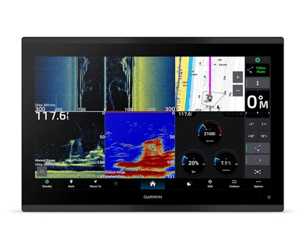
Garmin GPSMAP 9217 — Command-Level Clarity on the Open Water.
When you’re at the helm, you need gear that works as hard as you do. The Garmin GPSMAP 9217 delivers a commanding presence with its massive 17-inch WUXGA touchscreen — big, bright, and built for those who don’t settle for half measures. Designed for captains, offshore anglers, and long-range cruisers, this powerhouse chartplotter gives you the clarity, control, and confidence to navigate with precision. From shallow flats to bluewater crossings, the 9217 puts every chart, route, and waypoint right where you need it — bold and brilliant in any light.
Built to thrive in the harsh marine environment, the GPSMAP 9217 is all business. Its sunlight-readable, edge-to-edge glass display cuts through glare like a spotlight on calm seas, while the rugged IPX7-rated design laughs off spray, rain, and the occasional pounding wave. This is a display meant for the real world — reliable under pressure, clear in rough weather, and ready to lead from the helm of a sportfisher, yacht, or commercial vessel. With smooth touchscreen control and an intuitive interface, it keeps your navigation simple, seamless, and steady, no matter how the conditions turn.
Included in this bundle is a Garmin Navionics Vision+ chart card. Garmin Navionics Vision+ charts include both coastal and inland coverage within the region of your choice. Data is sourced from Garmin and Navionics to provide you with exceptional detail. These charts include 1-year of daily updates, ensuring your chart data is always current! Premium features include High Resolution Relief Shading, High Resolution Satellite Imagery, Sonar Imagery, Aerial Photography, SideScan Images, and More! Garmin Navionics Vision+ charts require premium content to be downloaded post-purchase.

Underneath that glass is Garmin’s proven performance engine — fast processing, rock-solid stability, and pinpoint positioning thanks to multi-constellation GNSS support (GPS, GLONASS, Galileo, BeiDou). You can store and manage thousands of routes, waypoints, and tracks, keeping every honey hole, harbor, and hidden passage ready for your next run. Preloaded Garmin Navionics+ mapping for coastal and inland waters provides detailed coverage right out of the box, along with QuickDraw Contours, which ensures you’re never navigating blind, whether you’re threading channels or crossing canyons.
Installation is straightforward, whether you’re rigging a luxury cruiser or a hardcore fishing machine. The GPSMAP 9217 can be flush, flat, or bail-mounted to fit your command center perfectly. It connects effortlessly to the Garmin Marine Network and NMEA 2000 systems, letting you link radar, autopilot, cameras, and engines into a single, unified display. Built-in wireless connectivity keeps you synced with your entire Garmin ecosystem, and with the ActiveCaptain® app, you can plan routes, update charts, and manage data right from your smartphone or tablet.
When visibility matters, and precision is non-negotiable, the Garmin GPSMAP 9217 delivers a big-screen experience worthy of the open sea. It’s more than a chartplotter; it’s your command console, your navigator, and your trusted lookout all in one. Big screen. Big control. Big confidence. Rule your route with Garmin.



Reviews
There are no reviews yet.