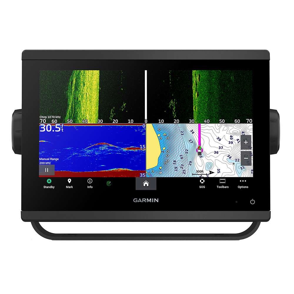
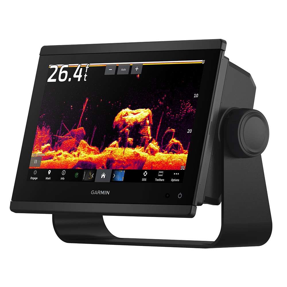
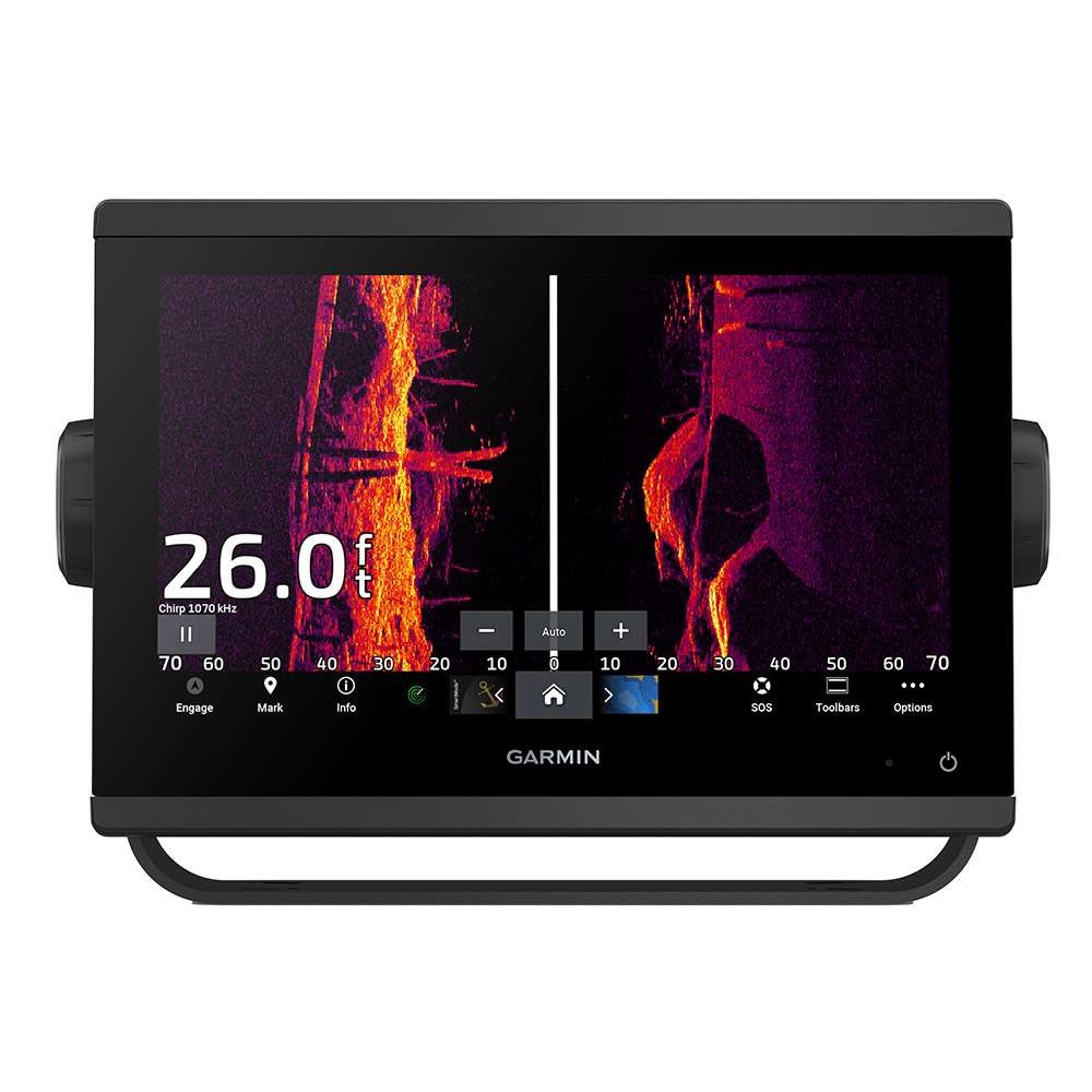
Garmin’s GPSMAP 943xsv Chartplotter/Sonar with GN+ is designed around an ultra sleek, 9” touchscreen display. Sunlight readability and visibility from any angle, the GPSMAP 943 features edge-to-edge glass with a smaller footprint, and includes both flush and bracket mount options with the included kits. Built with a 10Hz GPS/GLONASS/GALILEO internal antenna acquisition to satellites is quick and efficient – staying locked in and ensuring your map updates quickly – no more waiting on delayed map redraws. Garmin GPSMAP 743 GN+ Chartplotter
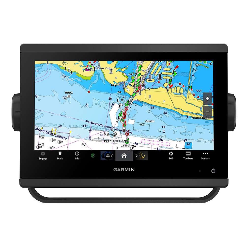
Charting: Preloaded with Garmin Navionics+ detail for the Coastal and Inland waters throughout the US, the GPSMAP 943xsv includes Auto Guidance+ technology. Offering Detail-rich charts of coastal waters, lakes, and rivers, the built-in charting now includes auto-routing solutions giving you a suggested path to follow through channels, inlets, marina entrances, and more. (*Please note, Auto Guidance+ is for planning purposes only and should not replace safe navigation) Preloaded Garmin Navionics Charts include detailed coverage of the entire U.S. coasts, lakes, rivers, and inland waterways, plus Alaska and Hawaii. Canada coverage of coastal British Columbia, the Great Lakes, the St. Lawrence Seaway, New Brunswick, and Nova Scotia. Coverage includes Bermuda, the Bahamas, Baja California, the Gulf of California, Johnston Atoll, and Palmyra Atoll/Kingman Reef. Garmin GPSMAP 9217XSV Navionics Vision+ Chart Bundle
Display: Offering a resolution of 1280×720 pixels, the GPSMAP 943xsv WXGA display provides the same vertical resolution as XGA displays but delivers 20% greater horizontal resolution for a crisper, clearer image! Waterproof to IPX7 standards and fully customizable, the 943xsv offers split screen options for viewing charts, optional sonar, radar, FLIR cameras, and more!

Sonar: Built with a 1kW Single Channel CHIRP sonar, the 943xsv also includes ClearVu and SideVu sonar capability when paired with the appropriate 12 Pin transducer (transducer required for sonar and sold separately). Fully compatible with Panoptix All-seeing sonar, your sonar options really are endless when it comes to the GPSMAP.
Premium Charting Options: The Garmin GPSMAP GN+ displays are compatible with Garmin Navionics Vision+ charts, Garmin’s premier chart offering. Garmin Navionics Vision+ charts include both coastal and lake coverage within the region of your choice. Data is sourced from Garmin and Navionics to provide you with exceptional detail. Regions are larger than previous charting from Garmin and provide High Resolution Relief Shading, Auto Guidance+ routing, High Resolution Satellite Imagery, Sonar Imagery, Aerial Photography, SideScan Images, and 1-year of free daily updates via the Garmin ActiveCaptain app! Garmin Navionics Vision+ charts require premium content to be downloaded post-purchase via the ActiveCaptain app with a compatible smartphone or tablet. All premium chart options are available in the region of your choice and sold separately.

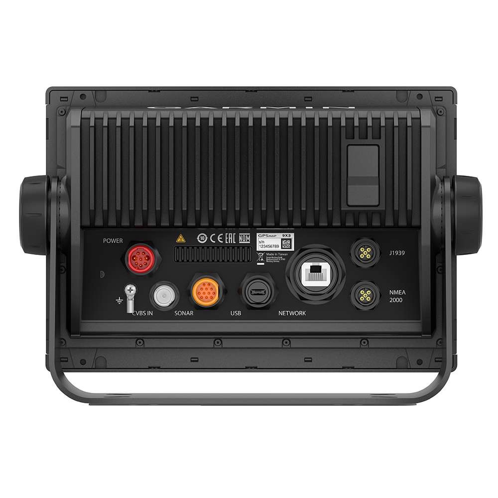
Network Support: Fully Networkable, the GPSMAP 943xsv offers a single network port for the addition of multiple displays, Radar, Sonar, SiriusXM, and more. If adding more than one network component, please note that a GMS10 port expander will be required (sold separately). In addition, the GPSMAP 943xsv supports both NMEA0183 and NMEA2000 (NMEA2000 starter kit required, sold separately) for connection to VHF, AIS, and other NMEA communication devices. Garmin GPSMAP 9217 Navionics Vision+ Chart Bundle
If you are in the market for a top choice, 9” multi-function display with charting and sonar options, look no further than the GPSMAP 943xsv chartplotter/sonar with GN+ mapping! You won’t be disappointed!
*Please note, this display has a single 12 Pin Transducer Port. Garmin 12 Pin orange connectors do not support speed through water via a speed wheel. This display will provide speed over ground via GPS. Speed through water can be achieved by adding a NMEA Smart sensor, sold separately. Garmin GPSMAP 9217 Multifunction Display



Reviews
There are no reviews yet.